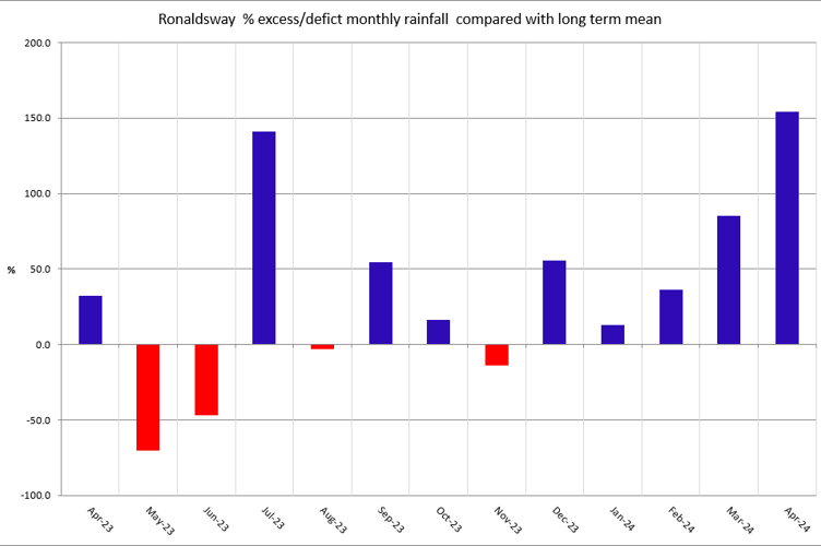
As expected, last month was the wettest April on record.
Forecasters at Ronaldsway have confirmed it was the fifth consecutive month with above average rainfall, with a total of 138.3mm collected, exceeding the previous record of 130mm in 1961.
While there was a week virtually dry, the first half of the month was very wet indeed, with the 0900-0900 total of 49.5mm on the morning of the April 9 being the wettest April day since the Met Office started measurements in 1947. Eight of the last 10 months have been wetter than average, with two; July and April, being the wettest on record.
Daytime temperatures were close to normal, with a mean maximum of 11.4°C, but with all that wet weather the nights were mild, with a mean minimum of 6.7°C which is about 1 degree up on the long term 30 year 1991-2020 average.
The highest temperature of the month was 13.5°C, recorded on the 6th – which was also the windiest day, with gusts of 52 knot (60mph) during named storm Kathleen.
The mean wind speed over the month was 13.6 knots; the 4th windiest on record.
As you’d expect sunshine hours were below normal, although a few dry days in the latter part of the month helped.
154.2 hours were burned on the cards, about 25 hours down on the average. The best day was April 26 with 13.9 hours.
After the gales on the 6th, and flooding on the 9th, there was fog on April 10, but no air frost, snow, hail or thunder observed at Ronaldsway.


